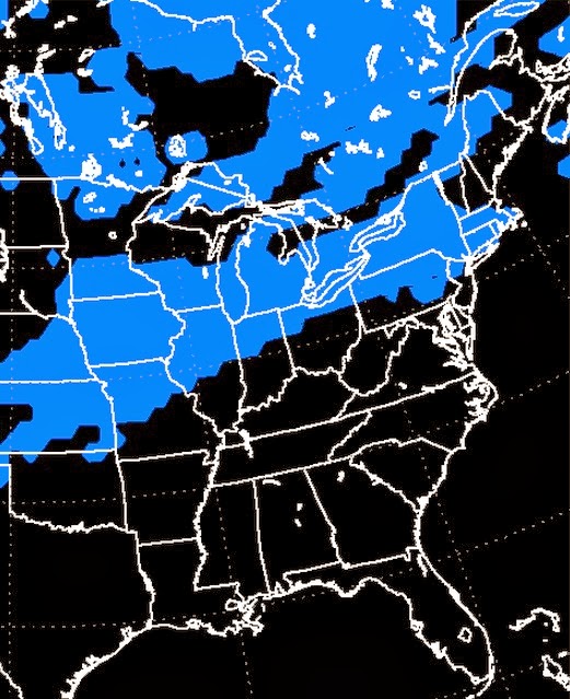
Take for example this Saturday. After a couple days in the 30s, colder air is going to push back into northern Ohio. A storm system will move over Ohio during the weekend and produce snow? How much? Well that depends upon exactly where the system goes. Below are two different forecast models. While both show snow during the morning, the NAM shows rain over NE Ohio on Saturday afternoon. The GFS model shows snow continuing. Yeah...that's the problem. No rain = more snow. Rain = less snow. Right now I'm leaning more toward the mix...snow in the morning and later in the day with a period of rain in the middle. That may change, so keep checking back.
 |
| GFS model shows SNOW over the area at 1pm Saturday |
 |
| The NAM shows RAIN over the area at 1pm Saturday |
You are already hearing talk about a possible snow storm the middle of next week. That's a good possibility as well. Similar to this weekend's storm is the uncertainty of the exact track of the system. Not so uncertain at this time is the fact that it will be snow instead of a mix of snow and rain. The question for next week's storm is just how much snow is going to fall across NE Ohio. We'll know more when we get a bit closer.
Like I said, the cold temperatures were a whole lot easier to predict.
Enjoy the sun and "warm".
No comments:
Post a Comment