This is Christmas Eve and an area of light snow will be heading into the region during the afternoon. It may even mix with rain for a while and then some freezing rain after dark. But, all in all, it won't amount to too much of a problem for you. (See map below)
 |
| Map courtesy of AccuWeather |
Christmas Day should see a mix of clouds and sun during the day. As we head toward the later part of the day, the clouds will thicken as a major winter storm heads up from the south. Current forecasts indicate that the snow should begin early on Wednesday morning and continue through the day and into the night. (See map below) This has the potential to be really big, but at the moment I'm looking at 5" to 8" generally by Thursday morning. Some forecast models are showing more than that, but I don't want to go there yet. We'll wait and see how this thing develops.
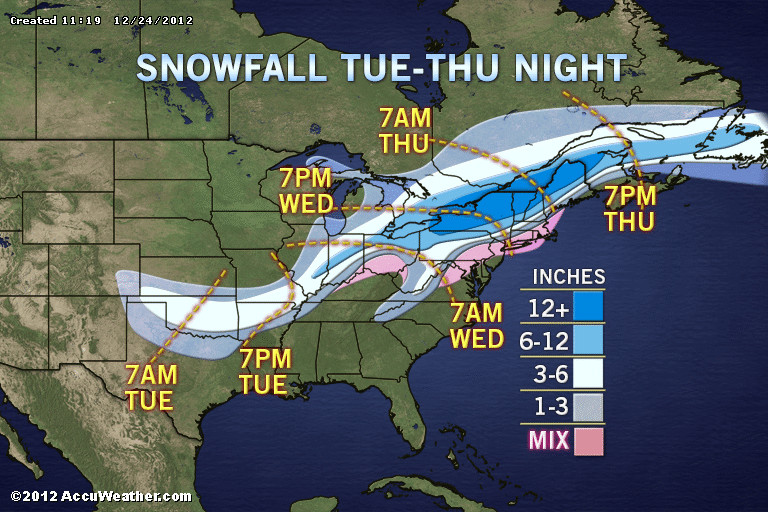 |
| Map courtesy of AccuWeather |
We should settle things down a bit on Friday, but another system will head our way for the weekend.
Whew! Busy times! Nothing at all like last winter.
Enjoy...and Merry Christmas from us here in the Weather Center!
No comments:
Post a Comment